
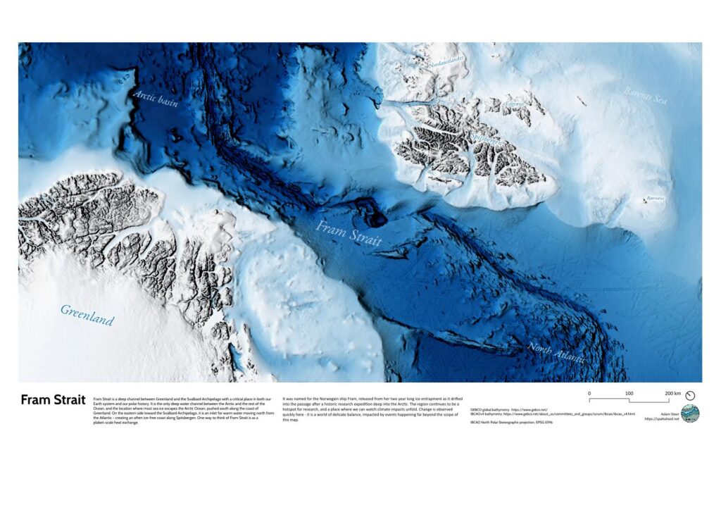
A visualisation of Fram Strait, developed from GEBCO global topography and bathymetry data.
The key design problem for this map was rendering bathymetric detail in both very shallow / low relief regions (Barents Sea) and very deep, high relief regions (Arctic Basin). A solution was found using a combination of layering and rendering methods in QGIS, with close attention to tint ranges and blending modes.
It is available as a physical and digital print – get in touch for ordering a copy, or requesting your own bespoke print of this region.