The work stuff. It’s all here! Arranged by ‘date started’ – so concurrent roles might seem out of order, but there is method in the madness. Some more focused career journeys are also provided:
Polar fieldwork, guiding, related roles
Community building and volunteering
Highlights
- 8 polar expeditions into drifting pack ice in the Antarctic and Arctic; developing research strategies for deployment in the field
- Leading small field teams on drift ice; training researchers and safety officers
- Elected director of OSGeo, a global NGO with a diverse, distributed board and membership
- PhD (surveying technology) with a polar geophysics focus – pioneering new methods of measuring and mapping drifting sea ice and snow
Current
Freelance geospatial consultant, Spatialised (https://spatialised.net)
Key attributes: innovation, project management, leadership, collaboration, business development, technical expertise, customer service
- Contract aerial survey operations, working in complex airspace and often very remote regions
- Data architecture and workflows
- Geospatial training and consulting
- Cartography design and training
- Geophysical / environmental data analysis and reporting
As the owner and principal consultant I work on client engagement and business development, project management using agile practice, resource and budget management.
Related portfolio work


March – June 2024
North Central District Operations Coordinator, Parks Victoria (https://parks.vic.gov.au)
Key attributes: leadership, budget development, budget management, team development, risk assessment, business strategy
Fixed term role delivering coordination of Parks Victoria resources across Victoria’s North Central region.
- Worked with Area Chief Rangers, Ranger Team Leads and the District Manager to identify priority tasks and plan annual budgets to support delivery of the Parks Victoria regional strategy.
- Worked with Ranger Team Leads to ensure that work centres were compliant with Parks Victoria essential safety measures and business operational principles; working to address district-wide workflow issues, for example Cultural Heritage assessments.
- Advocate for personal development and infrastructure needs across the district, in collaboration with the district leadership and district management teams.
- Line manager for a business administration assistant
July 2023 -January 2024
Field Operations Manager, Biik Cultural Heritage Unit, Taungurung Land and Waters Council (https://taungurung.com.au)
Key attributes: leadership, change management, communication, accountability
Working with the general manager of the Biik operations on country unit, and the Registered Aboriginal Party management, I led a team of 8 full time and 6 casual Taungurung traditional owners working on cultural heritage surveys across Taungurung country.
- A key role in advocacy for the needs of field crew, working to ensure that policy aligns with practice.
- Accountable for workplace practice and safety, professional development and team development.
- A strong change management component, developing consistent operational standards and doctrine across the business.
2021-2023
Director, the Open Source Geospatial Foundation (OSGeo): https://osgeo.org
Key attributes: leadership, mentoring, community maintenance, capacity building, advocacy
A volunteer role working with a spatially and culturally diverse team of directors to support a passionate community of open source geospatial software developers. Planning and setting budgets, forming and maintaining partnerships, resolving conflicts, and representing the open geospatial community in local and international forums. Elected for a two-year term in December 2021. Key achievements were the resolution of an MoU with the Open Geospatial Consortium, supporting FOSS4G conferences in Firenze and Kosovo, and an MoI with the European Space Agency.
2020-2023
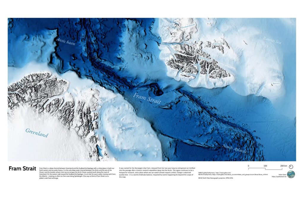
Postdoctoral researcher, Norwegian Polar Institute.
Key attributes: mentoring, research, polar fieldwork, safety, risk management, collaboration, advocacy
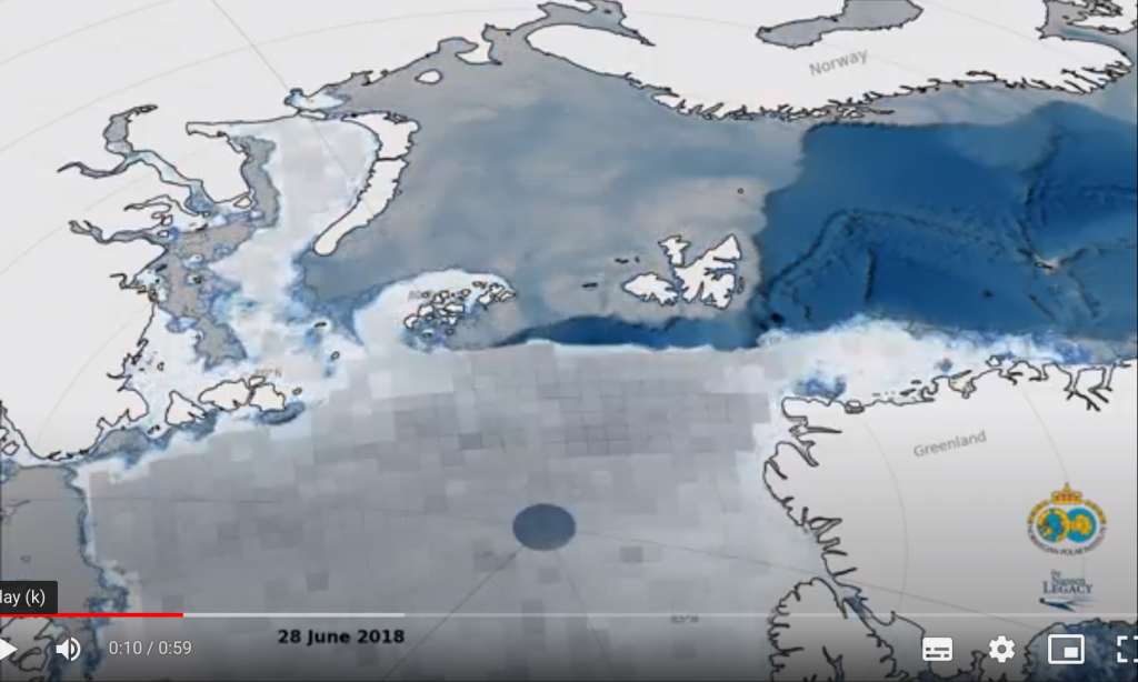
Sea ice physical properties specialist in the Norwegian Nansen Legacy Project (https://arvenetternansen.com).
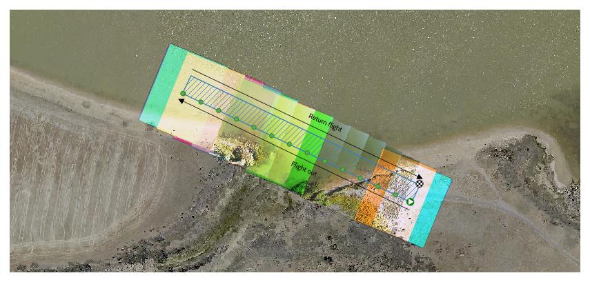
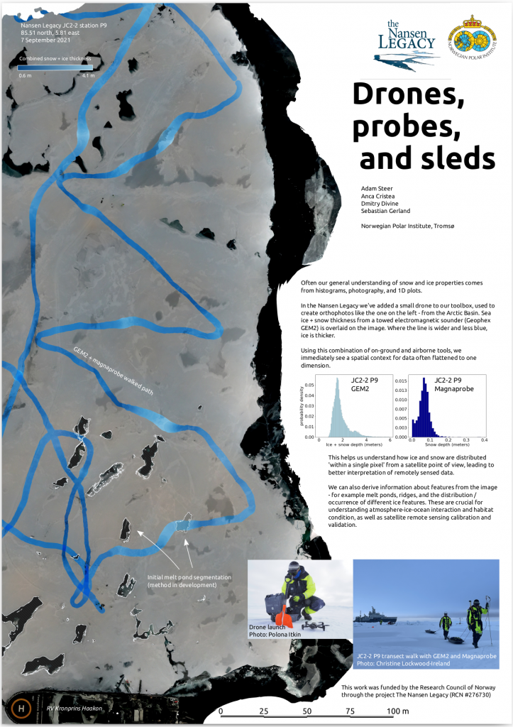
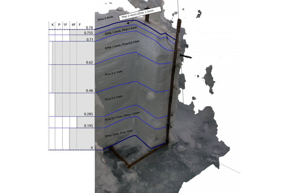
- Geophysical sampling program design and execution using drills, ice corers, ship based observations, snow pits, small drones, semi-automated snow probes and electromagnetic sounders.
- Analytical workflow data structure design for collected observations using FAIR data principles.
- Four voyages with RV Kronprins Haakon in Arctic pack ice during winter, spring and autumn – travelling up to 87.5 degrees north. I managed equipment logistics, set field program priorities, trained and mentored sea ice researchers in the field. I worked with NPI’s logistics team on risk analysis and management, field leadership, and safety components. I developed and helped shape risk assessments. I was responsible for planning field activities, continuous assessment of operational sea ice safety, finding safe routes, leading small groups in unexplored sea ice terrain and working as a polar bear guard.
- Co-organised and facilitated two sea ice field methods workshops near Tromsø, taking 15-20 students and researchers on to sea ice to demonstrate, practice with and test equipment.
- Co-organised and facilitated the 30-person 2022 Nansen Legacy multi-disciplinary sea ice workshop (Tromsø).
- Presented work at the 2022 ESA Living Planet Symposium, annual Nansen Legacy workshops, the 2022 FOSS4G-NOR meeting, the 2021 CIRFA annual conference and an invited CIRFA seminar In 2023.
Related portfolio work
2018-2019
Sponsorship lead, founding director, elected director, OSGeo Oceania (https://osgeo-oceania.org)
Key attributes: community building, community maintenance, fundraising, mentoring, collaboration, leadership
In 2018 a community got together and ran the first open source geospatial software conference in the Oceania region since FOSS4G 2009. I led the effort to raise money for the event, and created the Good Mojo program which allocated funding specifically for DEI initiatives – for example travel grant programs, funding the inclusion of children at conferences, and networking events.
Based on the incredible success of that event, the organising committee formed a not-for-profit company, OSGeo Oceania, to support future events and the community in general. I was a founding director, then elected director.
2017-2018
Geospatial research lead, Synthesis Technologies.
Key attributes: strategic technology awareness, business development, product development, rapid prototyping, teamwork
First employee of Synthesis Technologies, a startup pioneering exploitation of massive point clouds in XR / mixed reality, developing a product for virtual situational awareness training with a defence focus.
- Provided subject matter expertise and strategic insight for geospatial components from ethical concerns to technological developments and reasoning behind technology choices.
- Contributed to a successful Australian Defence Innovation Fund bid, as well as funding bids across the private and public sector.
2016 – 2017
Senior earth systems data specialist, Australia’s National Computational Infrastructure.
Key attributes: research customer interaction, training delivery, service development, teamwork, concept leadership, research
Earth systems data subject matter expert, services developer and trainer.
- Provided advice to researchers on data storage and management, solved problems with existing data services and addressed gaps by exploring innovative ways to deliver NCI’s geospatial data holdings.
- Developed and delivered workshops on using NCI services (NCSS, OGC web data services),
- Delivered the NCI component of Earthserver2, a European Union Horizon2020 project.
- Developed an Open Geospatial Consortium (OGC) standards based point cloud delivery service to working prototype, presented in a poster at the 2017 European Geophysical Union (EGU) conference and a talk at FOSS4G 2017.
2014 – 2016
Workshop / sales, Uni Cycles, Canberra, Australia.
Key attributes: customer service, technical competence, mentoring
Mechanic, mentor, trainer, workshop manager and salesperson at a small bicycle store in Canberra, Australia.
2009-2016
Doctoral candidate, Surveying and Spatial Sciences, School of Land and Food, University of Tasmania.
Key attributes: project leadership, concept development, polar logistics, fieldwork, field team management, mentoring, helicopter operations, safety assessment, risk assessment, data analysis and synthesis, project prioritization
Doctoral research fellowship developing novel approaches for estimating Antarctic sea ice thickness using airborne lidar and related airborne remote sensing technologies.
- Australian Postgraduate Award (APA) fellow
- worked through complex logistical issues around Antarctic shipping and helicopter operations.
- developed international collaborations, led small teams on Antarctic pack ice, worked with multinational teams aboard research icebreakers.
My doctoral thesis ( https://eprints.utas.edu.au/23441/ ) provides engineering and data analysis details.
Related portfolio work

2007-2013
Sea ice research technical officer (research engineer), Australian Antarctic Division, Hobart, Tasmania
Key attributes: data analysis and synthesis, data visualisation, project leadership, polar logistics, field team management, mentoring, safety and risk assessment, helicopter operations.
Coordinating logistics and field support for the sea ice physical processes team in the Australian Antarctic division on four expeditions to the east Antarctic pack ice zone aboard RSV Aurora Australis. Two were international multi-disciplinary research expeditions ( SIPEX 2007; SIPEX II, 2012) and two were resupply trips to Davis Station (V1 2008; V1 2009).
- Managed an airborne surveying platform and ground observations.
- Recruited, trained and mentored sea ice observers and fieldwork assistants
- Worked on integrating airborne lidar, photogrammetry, ship based observations and in situ sampling. Pioneering the use of texture based image analysis and structure-from-motion photogrammetry on drifting sea ice.
- Contributed cartography, data analysis, data visualisations and novel analytical methods to peer reviewed publications
2005-2008
Hiking guide, Cradle Mountain Huts (now Tasmanian Walking Company)
Key attributes: leadership, mentoring, customer service, sensitive landscape operations, landscape interpretation
Responsible for the overall experience of up to 10 guests on a 6 day expedition on Tasmania’s iconic Overland Track.
- Group leadership and management, incident management and customer care
- Ensuring that quality and safety expectations were met in all aspects from interpretive guiding to cooking, cleaning and minor hut maintenance in a world heritage wilderness area.
- Mentoring and training new guides
- Coordinating with park rangers and other guided parties as needed for emergencies or general camaraderie in the park.
Pre-2005
Student – Bachelor of Antarctic Studies (honours), Institute of Antarctic and Southern Ocean Studies, University of Tasmania, 2004.
Web publishing officer, Australian Library and Information Association. 1999-2001 and 2002-2004
Outdoor equipment retail sales, Nevisport, Edinburgh, Scotland, late 2002
Night watch, Caribisdale Castle, northern Scotland, early 2002
Front desk, Banff International Hostel and relief manager, Castle Mountain YHA, Banff and region, Alberta, Canada. May to October 2001
Ski lift operator, Fernie Alpine Resort, Fernie, British Columbia, Canada – winter 2000/2001
Teaching assistant (6 month contract), Canberra Institute of Technology, Canberra, Australia, 1999.