-
Mapping static avalanche risk factors
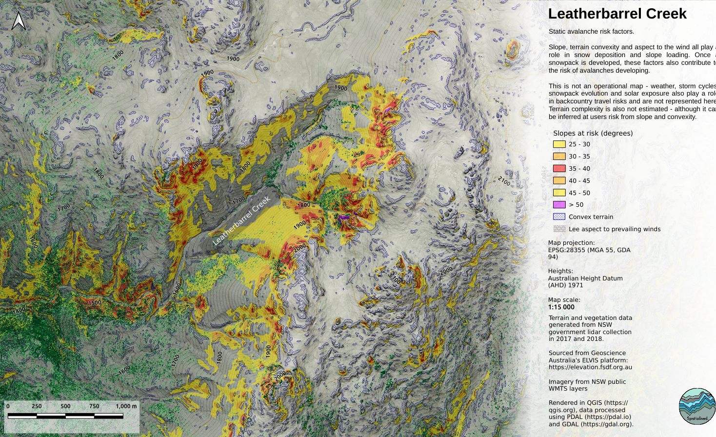
A project to map terrain-based static features which contribute to avalanche occurrence, using popular backcountry ski destinations in New South Wales, Australia. See the full story: https://www.spatialised.net/mapping-avalanche-risk-factors/