-
High latitude drone surveys
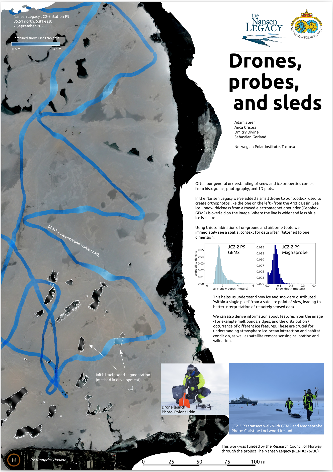
I’ve added small drones to the sea ice research toolkit at the Norwegian Polar Institute, using them to collect imagery for Structure from Motion reconstruction of work sites and local topography. I also developed techniques for mapping flights when the world we occupy is moving, and autonomous planned flights cannot be used. This work has…
-
Mapping sea ice motion
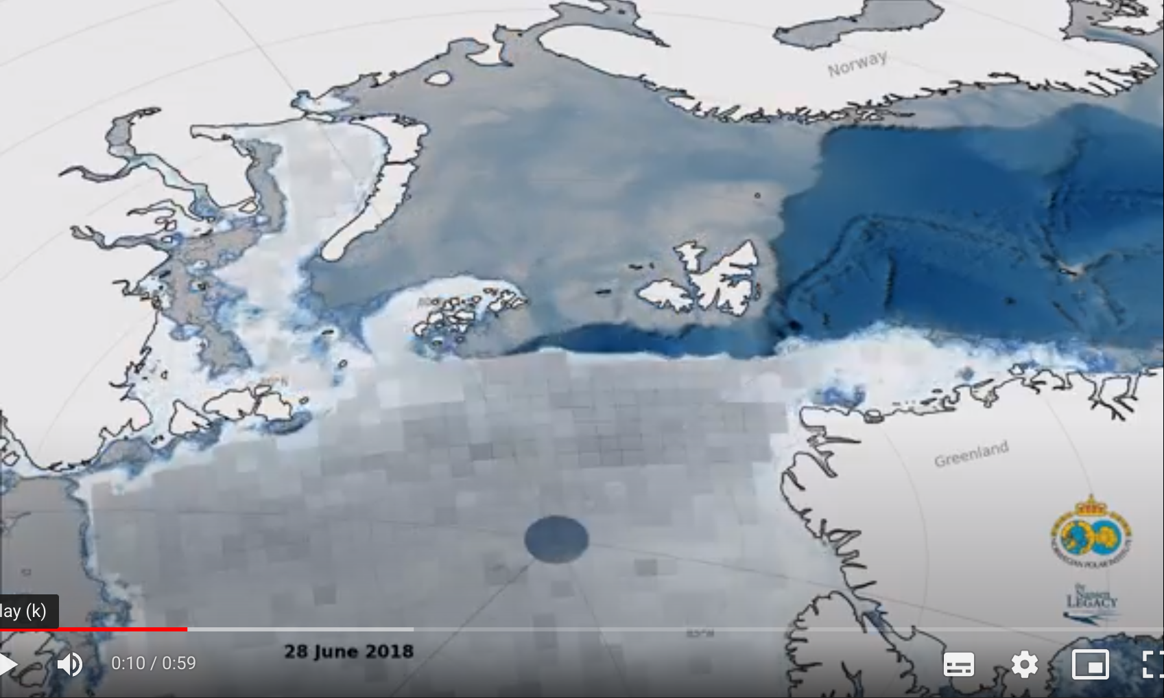
In the Nansen Legacy Project, researchers work to understand how sea ice in the Northern Barents Sea behaves. We see a lot of static imagery and graphs of sea ice, this project attempts to add a more dynamic perspective. Using sea ice extent, concentration and motion data this short film shows daily sea ice state…
-
3D reconstruction of a snow pit
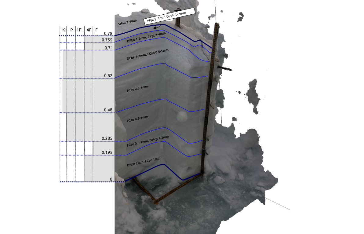
A photogrammetric reconstruction of a detailed snow pit on Arctic sea ice